Contec Develops AI Super Resolution for Existing Satellite Images
South Korean space firm Contec says it has secured core AI super-resolution technology that sharpens existing satellite images without new launches or costlier cameras.
 SUMO· the number puzzle
 Dialo· learn languages by speaking
 ediviewer· read EDI files like documents
 giftdetect· the right gift in minutes
South Korean space systems and solutions company Contec said on November 6 that it has secured core artificial intelligence technology for super resolution, working jointly with a domestic organization it did not name. According to the company, the technology can improve the resolution and quality of existing satellite imagery without launching another satellite or buying high-performance imaging equipment.
Validated on two satellites
Contec said two years of joint development with the partner, referred to only as Organization A, ended with validation of the AI approach on images from Korea's KOMPSAT-3A (Arirang 3A) and the US commercial Earth-observation satellite WorldView-3.
President Seo Dong-choon said the team applied AI to imagery at several spatial resolutions, including 1 meter, 50 centimeters and 30 centimeters. The result, he said, is a general-purpose AI model that is not tied to one particular satellite and can improve quality across different sources.
Aiming at export markets
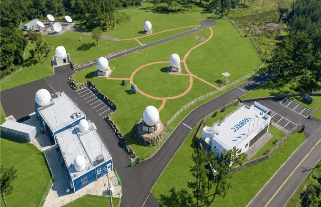
Contec says it covers the full satellite-data cycle, from building and operating ground stations to receiving, processing and analyzing imagery. It plans to step up exports of the solution to overseas satellite operators and service companies.
The company also intends to combine the technology with AI-based image analysis and expand into higher-value global satellite information services for defense and security, disaster monitoring and urban development.
Seo said the technology lifts the quality and usability of existing imagery and so raises the economic value of the data. He added that Contec will actively pursue exports of AI-based, high-value image processing solutions aimed at the global satellite imagery market.
Apps worth a look
SUMO: the number puzzleTap the right tiles, add them up, hit the target. Easy to learn, hard to master. Free, for all ages.
Dialo: learn languages by speakingTalk to an AI conversation partner; every sentence comes back corrected and explained in your language. 9 languages, A1 to C2.
ediviewer: read EDI files like documentsOpen EDIFACT and X12 messages, see every segment explained, convert to JSON/XML, export PDF and Excel. Runs locally, no upload.
giftdetect: the right gift in minutesPick who it is for, the occasion and their personality. The search engine reads product descriptions from local shops and ranks what fits. Free, no sign-up.
More from this day
See all →
GOG GALAXY Is Coming Natively to Linux After 18 Years
Claude Code accused of leaking users' email addresses to websites

Alta Ares wins six NATO counter-drone lots in first big deal

NCBR Sets Aside PLN 25 Million for International AI R&D Projects
More in: Space
See all →
SpaceX Targets Friday the 13th for Starship Flight 15 Double Catch
Blue Origin unveils New Glenn GS3 third stage and Northstar engine