AltNav: a drone flew 6 hours over the Pacific without GPS
A ScanEagle drone found its way over open ocean for six hours using only cameras and motion sensors. Waves, which never hold still, were the hard part.
 SUMO· the number puzzle
 Dialo· learn languages by speaking
 ediviewer· read EDI files like documents
 giftdetect· the right gift in minutes
Try navigating by looking at water. Every wave moves, changes shape and throws back light differently, so there is nothing to pin a map to. That is the problem the US Naval Postgraduate School and Rhoman Aerospace set out to solve with AltNav, a navigation system that lets a drone fly over the sea without GPS.
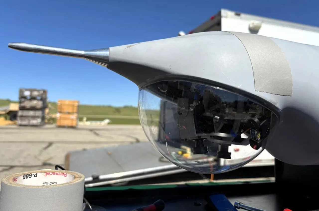
In tests near San Clemente Island off California, a Boeing Insitu ScanEagle spent six hours in the air a few kilometres from shore, at different altitudes and along set routes. It reached its waypoints, and according to Rhoman the drift of its positioning system was under 0.5 percent of the distance flown.
How does AltNav work without GPS?
It relies on visual-inertial odometry. Cameras watch the surroundings, accelerometers and gyroscopes track movement and orientation, and the onboard computer combines that with flight data to estimate where the drone is. Similar tech exists in robots and self-driving cars, but waves complicate it: their motion in the image does not match the drone's real movement. Rhoman says it tuned its sensor-fusion algorithms for this, and the system can work with or without pre-made maps.
It is paired with the school's CAA autonomy architecture. Rhoman estimates position, CAA flies the mission. When GPS and the link to the ground station were simulated as lost, the onboard computer carried on with the plan. Researchers could still supervise and step in.
What does 0.5 percent drift actually mean?
Over 100 kilometres, 0.5 percent is 500 metres. But that is a drift rate, not a measured miss distance at a target. The team has not said how much of the six hours was flown under simulated GPS and link loss, and has published no results for night flights, heavy rain or rough seas. So it is a solid result, not proof it works everywhere.
Next, the team plans to move the system to the larger AeroVironment JUMP 20, which takes off and lands vertically, and test a wider range of weather and sea conditions. The maker stresses the system is small and cheap, without giving figures.
Apps worth a look
SUMO: the number puzzleTap the right tiles, add them up, hit the target. Easy to learn, hard to master. Free, for all ages.
Dialo: learn languages by speakingTalk to an AI conversation partner; every sentence comes back corrected and explained in your language. 9 languages, A1 to C2.
ediviewer: read EDI files like documentsOpen EDIFACT and X12 messages, see every segment explained, convert to JSON/XML, export PDF and Excel. Runs locally, no upload.
giftdetect: the right gift in minutesPick who it is for, the occasion and their personality. The search engine reads product descriptions from local shops and ranks what fits. Free, no sign-up.
More from this day
See all →
Waymo highway ban: California halts robotaxi freeway rides

Sam Altman wants everyone to have lots of RAM, after prices soared

OLED TV flaw found in an 18,000-hour test hits LG and Sony