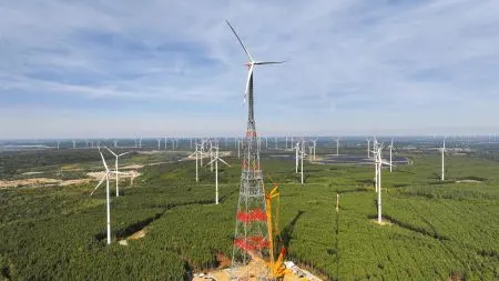
Los Santos flooding study: scientists drown a GTA 5 city
Two geoscientists used a fan-made GTA 5 map to simulate sea level rise in Los Santos. In the worst case, 6.5% of the city's land is underwater by 2500.
 SUMO· the number puzzle
 Dialo· learn languages by speaking
 ediviewer· read EDI files like documents
 giftdetect· the right gift in minutes
Rockstar wouldn't hand over its map data, so two scientists found another way to flood Los Santos, the Los Angeles lookalike from GTA 5. Their study came out on 17 November, the same week GTA 6 launched.
Paul Nörenberg of the University of Potsdam and Hugues Lantuit of the Alfred Wegener Institute published it in Geoscience Communication. They applied IPCC climate scenarios (the UN climate panel's projections) to the game's terrain. The neighbourhoods flood in the same order as in real Los Angeles. The idea is older than the GTA 6 buzz: it grew out of Nörenberg's 2020 master's thesis, and the journal has already covered Zelda: Breath of the Wild and Pokémon Legends: Arceus.
How do you flood a city that doesn't exist?
Rockstar refused to share terrain data, citing its rights as publisher. So the researchers used a 3D map of the game posted by a fan on Sketchfab and converted it into an elevation map. They used Mount Chiliad, the game's highest point at 798 metres, as a height reference. They then measured six tracks, bridges and roads with the in-game GPS, always in the same sedan, and set sea level from 31 beaches checked by helicopter.
They ran two scenarios for 2100, 2300 and 2500: strongly falling emissions (RCP 2.6) and very high emissions (RCP 8.5). For a storm, they added the highest tide ever recorded in Los Angeles, 1.59 metres on 10 January 2005. With high emissions, water reaches 5.18 metres in 2300 and covers 5.1% of the land. In 2500 it hits 8.22 metres and 6.5%, and the harbour, the sewage plant and the gasworks stop working. With deep emission cuts, flooding stops at 2.2% in 2300 and no major infrastructure is hit.
Can you trust the numbers?
Not too far, and the authors say so. Their "bathtub" model fills the terrain to a fixed level, without waves, erosion or sinking ground, which tends to overstate flooding. The terrain is accurate to about 2 metres and ignores buildings that would slow the water. For 2300 and 2500 they used the high end of projections the IPCC considers unreliable. "These maps show which areas lie below that water level, not where the water would actually go," Lantuit said.
So it won't forecast Los Angeles. The game "cannot replace a scientific elevation model," Lantuit admits. The authors rule out classrooms, since GTA 5 is rated 18+, and point teachers to openly licensed Minecraft material. They see uses in museums, with YouTubers who already play GTA 5, and in teaching people to read flood maps, which are often misunderstood.
Apps worth a look
SUMO: the number puzzleTap the right tiles, add them up, hit the target. Easy to learn, hard to master. Free, for all ages.
Dialo: learn languages by speakingTalk to an AI conversation partner; every sentence comes back corrected and explained in your language. 9 languages, A1 to C2.
ediviewer: read EDI files like documentsOpen EDIFACT and X12 messages, see every segment explained, convert to JSON/XML, export PDF and Excel. Runs locally, no upload.
giftdetect: the right gift in minutesPick who it is for, the occasion and their personality. The search engine reads product descriptions from local shops and ranks what fits. Free, no sign-up.
More from this day
See all →
Oussama Ammar jailed 16 months by UK court over frozen assets
GTA 6 furry ban: Leonida makes it illegal and hunters shoot
Howl humanoid robot is being trained to collect eggs from coop floors